Oil/gas/coal
Global Fuel Exploitation Inventory (GFEI) of methane emissions from oil, gas, and coal
I use greenhouse gas emission inventories, geospatial data, and remote sensing observations to improve our understanding of the anthropogenic sources of greenhouse gas emissions. In my work, I use observations to identify new greenhouse gas emission sources and characterize their emissions over time. My goal is to leverage the global scale of satellite observations to identify the human activities that contribute to methane and carbon dioxide (CO2)emissions so that these activities can then be reduced through climate policy.
Oil/gas/coal
Global Fuel Exploitation Inventory (GFEI) of methane emissions from oil, gas, and coal
National Emissions
Gridded inventories of anthropogenic methane emissions in Canada and Mexico
Observations
Using observations in inverse modeling to improve emission estimates
Co-emitted gases
Leveraging satellite observations of co-emitted trace gases to track CO2
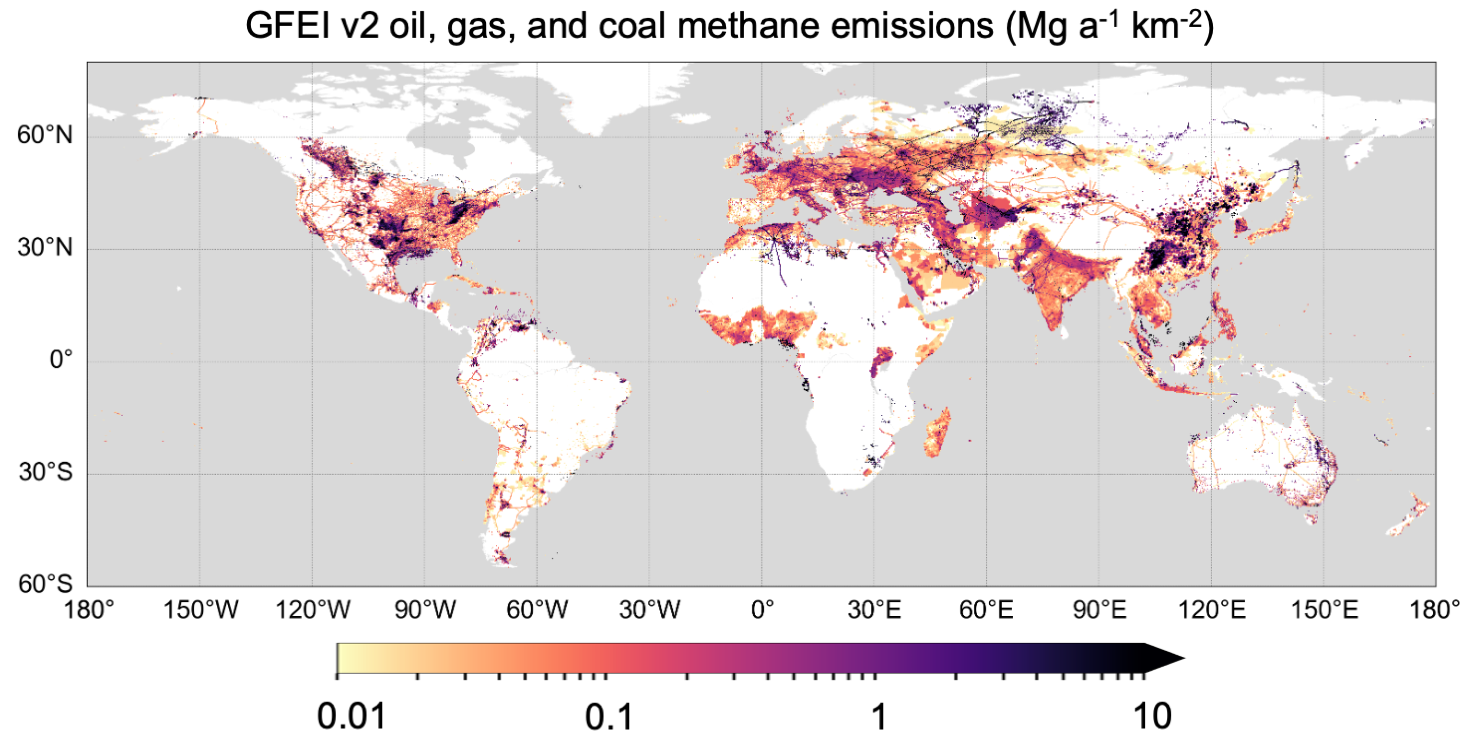
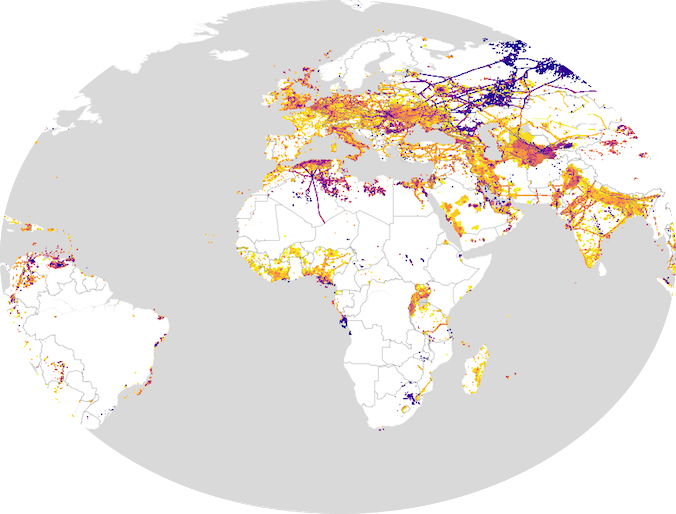
We created the Global Fuel Exploitation Inventory (GFEI). GFEI is a spatial representation of methane emissions from oil, gas, and coal exploitation. The resulting spatial resolved inventory can be compared to and informed by the spatial pattern of satellite observed methane concentrations in the atmosphere (see Atmospheric Observations). In this way we use observations of the atmosphere to improve our emissions estimates that are used to develop national and international climate policy.
We create the gridded inventory by allocating national methane emissions inventory as reported to the United Nations Framework Convention on Climate Change (UNFCCC) to source locations including wells, mines, refineries, processing plants, and pipelines.
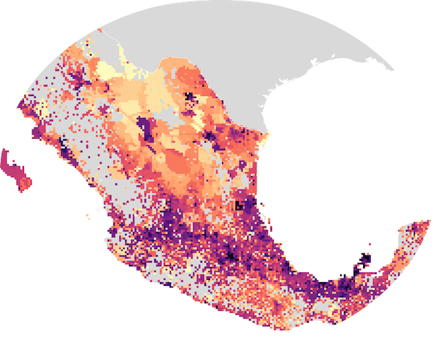
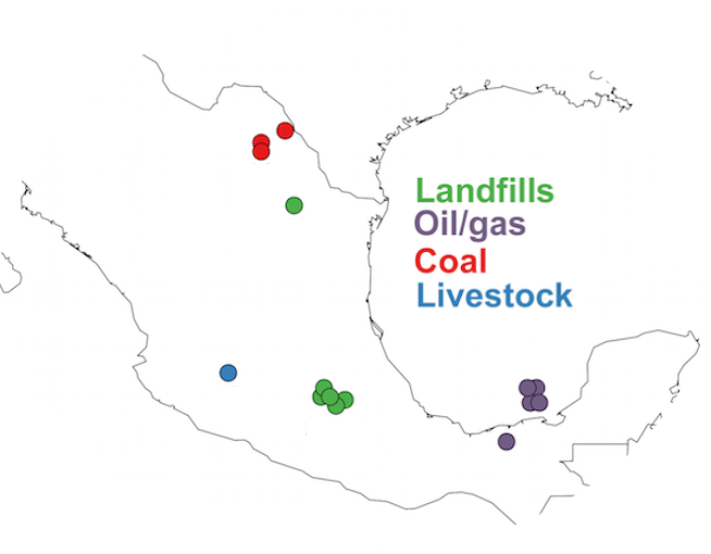
Mexico has made commitments to reduce its methane emissions, especially targeting oil and gas emissions. We create a gridded inventory of Mexico's anthropogenic methane emissions and investigate potential hotspots using the local facility information embedded in the gridded inventory.
In collaboration with the Institute of Ecology and Climate Change (INECC) in Mexico we spatially allocate Mexico's methane emissions to source locations. We use emissions reported in the National Inventory of Greenhouse Gases and Compounds provided by INECC.
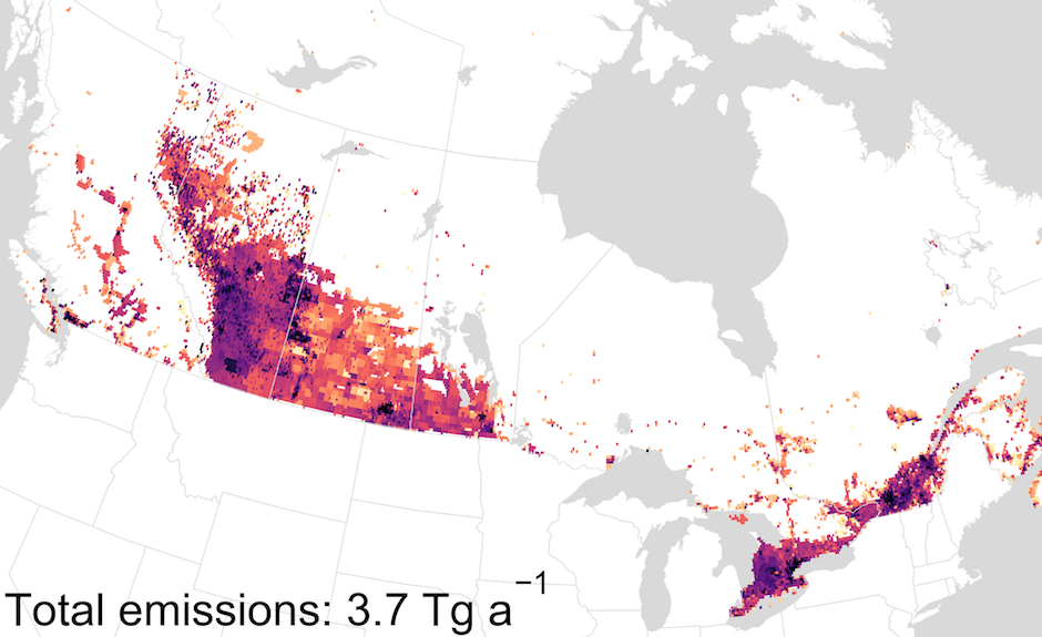
Canada's oil and gas production activities, including oil sands exploitation, produce significant methane emissions. Environment and Climate Change Canada annually reports Canada's anthropogenic methane emissions to the United Nations but oil and gas estimates have significant uncertainty.
We distribute these emissions to a grid using national geospatial datasets incorporating facility reported emissions in Canada's Greenhouse Gas Reporting Program and use the resulting inventory to identifying potential emission hotspots.
We use satellite observations of atmospheric methane, CO2, and co-emitted trace gases to better understand the magnitude of emissions and their temporal variability. I work primarily with the GEOS-Chem chemical transport model which allows us to translate a prior estimate of emissions to a resulting atmospheric concentration. We can then compare this modeled atmosphere to our satellite observations in an effort to adjust the emissions to better match our observations.
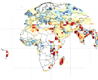
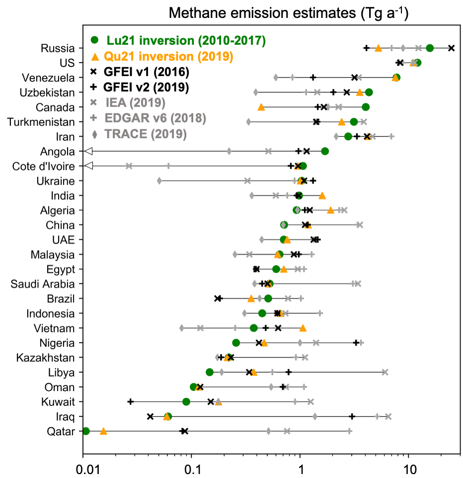
We have used methane inverse modeling to compare our oil and gas emissions in GFEI to satellite observations of atmospheric methane from the GOSAT satellite. National estimates of methane oil and gas emissions (as shown to the left) vary between different inventories and between methane inversion estimates. We identify underestimates of oil and gas methane emissions reported by some high emitting countries to the UNFCCC.